
Charlottesville Neighbors by Block
A block search works best when each source answers its own narrow question. The GIS map identifies parcel shape, address, parcel ID, owner label, and surrounding context. Assessor and land-book records add the property trail. Deeds and plats are the title and boundary sources. Voter material is governed by a separate statute and has protected exclusions. Historical directories and ACHS collections can help explain past households or organizations, but neither becomes a current roster. Start with the parcel, then choose the record that matches the question.
| Block record | What it can show | Charlottesville access |
|---|---|---|
| GIS parcels, addresses, and owner labels | Parcel geometry, mapped address, parcel ID, and owner label | Free Identify, Measure, Print, and Share Map tools |
| GIS ZIP, precinct, and neighborhood layers | Administrative context and boundary differences around a street | Free map layers listed by the City dynamic map service |
| Assessor and land books | Owner, deed or plat references, annual legal-description and value rows | GIS, public assessor computer, appointment, PDFs, and clerk books |
| Deeds and plats | Transfer chain, lot or block, and legal boundary references | Circuit Clerk index, available images, counter, and local records routes |
| Voter lists | Statutory registration fields, subject to exclusions and request rules | Locality inspection route under Title 24.2 |
| ACHS and reverse directories | Historical household, organization, and neighborhood leads | Research-library collections, PDFs, and microfilm with year gaps |
Owners, voters, and occupants are different categories. A parcel owner may be a trust, an organization, or a person with a mailing address elsewhere. A parcel can also contain more than one household. The map can establish what touches the block; it cannot establish every person who spends time there.
Charlottesville Parcel Adjacency
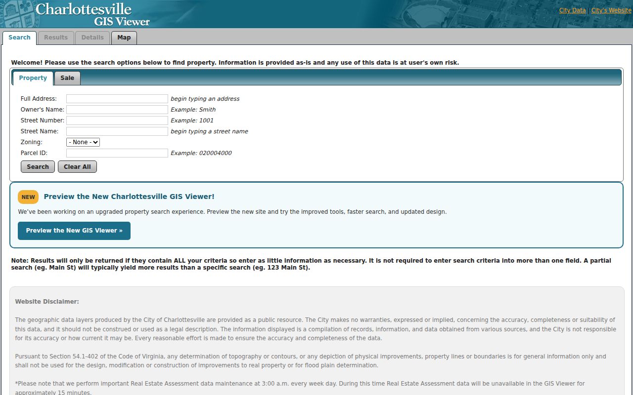
The City GIS Viewer supplies the practical adjacency method for neighbors. Search the target by full address, street number, street name, owner name, parcel ID, zoning, sale date, or sale price. The search fields are combined, so begin with one partial field instead of narrowing the result with several conditions. Select the target result, record the full address and parcel ID, then turn on Parcels, Parcel ID Numbers, Addresses, Roads, and any context layers needed for the question.
- Zoom to the target address in the City GIS Viewer and use Identify to open the parcel details.
- Click the polygons that share a frontage or boundary, recording each parcel ID and displayed owner label.
- Turn on ZIP Code Areas, Planning Neighborhoods, Polling Places, Voting Precincts, or school-zone layers to understand the surrounding boundaries.
- Use Measure for a physical block context, then Print or Share Map to preserve the map view and the date checked.
- Use the assessor or clerk only when an owner, deed reference, or legal boundary needs confirmation.
The captured Charlottesville GIS Viewer shows the property and sale search fields used for that first parcel step.
The map result is a starting point. City data is compiled from multiple sources, is not warranted complete or current, and is not a legal description for construction or boundary decisions.
Charlottesville Neighbors and Voter Records
Virginia voter material is not a general block search. Under Va. Code § 24.2-444, public registration lists include name, address, year of birth, gender, and applicable election districts. They exclude Social Security numbers, the day and month of birth, protected residences, registration declination, and registration-agency identity. Individual VERIS records and voting history are not public under VFOIA. The Virginia Citizen Portal is secure self-service for a voter’s own status, not a way to build a block list.
For a lawful historical or statistical question, use the locality that holds the parcel. Charlottesville Elections is at 120 7th Street NE, Room 142, Charlottesville, with phone 434-970-3250. If the parcel is outside city limits, Albemarle Elections is the correct route at 434-972-4173. A Charlottesville mailing address does not prove that a property is inside the city, so check the GIS city-limit layer before choosing an office.
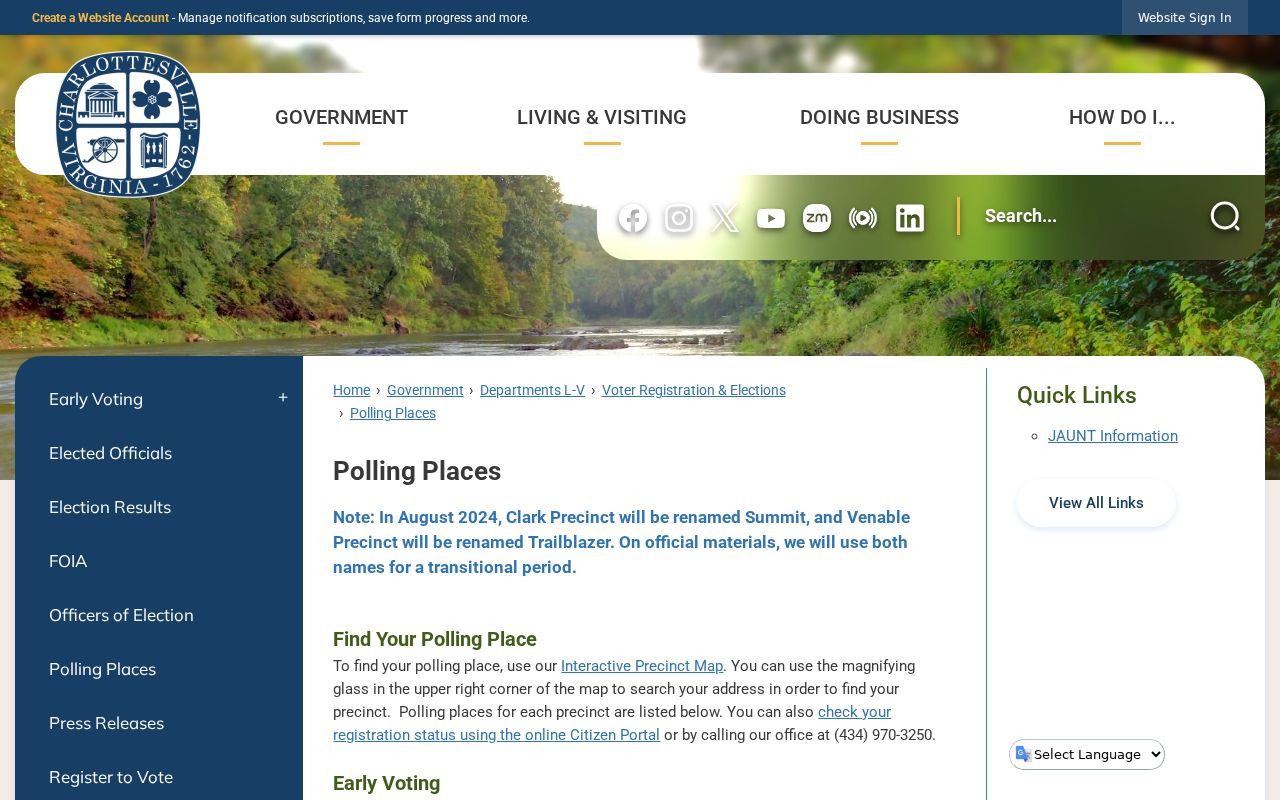
The Charlottesville polling-place resource is the official address-to-precinct context shown in the captured map.
A precinct is an election boundary, not evidence that everyone inside it is a neighbor or a member of one household.
Note: A protected address or a failed public search is not evidence that a person has left Charlottesville or the surrounding locality.
Charlottesville Block Context Layers
The City’s Dynamic Map Service helps explain why adjacent parcels can show different administrative labels. Its layers include Parcels, Structures, Addresses, Zoning, Parcel ID Numbers, Roads, City Limits, ZIP Code Areas, Planning Neighborhoods, Polling Places, Voting Precincts, school zones, parks, flood layers, and other map context. A block can cross a ZIP area, sit near a city line, or include a nonresidential parcel even when the street appears continuous.
Use layers as context, not as a person finder. A public park, cemetery, school, utility site, parking lot, vacant land, or multi-unit parcel can touch the same block. For a title question, compare the GIS parcel with the clerk’s deed and plat. For an owner-history question, the City Assessor maintains hard-copy history files with ownership, deed and plat references, ownership history, and improvement information. The office asks callers for an owner name, physical address, or nine-digit parcel ID.
The local count matters: the City’s published planning framework has 20 planning neighborhoods. That designation gives a useful map and context layer, but it does not provide a membership roll.
Charlottesville Planning Neighborhoods
Charlottesville’s Neighborhoods page publishes factsheets for 20 planning neighborhoods, including 10th and Page, Belmont, Fifeville, North Downtown, Ridge Street, Rose Hill, Venable, and Woolen Mills. The factsheets offer area, population context, maps, and city planning contacts. They do not publish resident names. This distinction matters when looking for community information: a planning boundary is useful for orientation, while a voluntary group’s participation list is not a public-record substitute.
The research located historical, not current, community documentation. North Downtown Residents Association material appears in the ACHS Thomson/Rawlings/Carver collection as newsletters, bylaws, and bulletins from 1973 through 1984. No authoritative current private-association member directory was located. The appropriate route is the city factsheet system for public planning context and ACHS for historical collection access, not an assumed current contact list.
| Community resource | Research-supported contact or access | What the record supports |
|---|---|---|
| City planning-neighborhood factsheets | City page with factsheets and planning context for 20 neighborhoods | Maps, area, population context, and city contacts, not household membership |
| ACHS Research Library | McIntire Library, Market Street Park, 200 Second Street NE, Charlottesville, VA 22902; 434-296-1492; questions by form or email | North Downtown Residents Association archive, vertical files, maps, oral histories, and local organization material |
| Central Virginia Genealogical Association material | ACHS holds volumes 1–38 of Central Virginia Heritage | Published family, cemetery, church, and local abstract leads, not a current community directory |
ACHS asks visitors to make appointments when possible so material can be pulled. Its staff does not conduct research on a patron’s behalf, so a concise name, address, and approximate year makes an archive request more useful.
Charlottesville Neighbors in Archives
Archives give a block a longer story. ACHS holds vertical files for families, businesses, houses of worship, schools, and wars, along with maps, newspapers, property papers, and oral histories. Its records also document places such as Vinegar Hill, Fifeville, and North Downtown where people or buildings may no longer be visible in a current parcel view. The collections can identify an older community connection, a historic organization, or a former street use that makes a deed or directory entry easier to interpret.
North Downtown’s archived association papers illustrate the difference between a block today and a block over time. A newsletter or bylaw can date a community effort, but it is not permission to contact a private person or a claim that a past participant remains nearby. Use historical material with the same care as a directory: preserve the date and source, then corroborate a property fact through the appropriate public custodian.
Comparing Charlottesville Neighbor Tools
Official records and commercial neighbor tools have different limits. The official route divides information by custodian and shows what the underlying record actually supports. Commercial services often combine parcel data, historical addresses, marketing information, and third-party material. That can be convenient, but it can also be stale, over-inclusive, or attach a relative to the wrong address. A parcel result or a commercial match should be treated as a question to verify, not as a complete account of who lives on a block.
| Approach | Useful for | Key limit |
|---|---|---|
| GIS, assessor, and deed records | Parcel, owner of record, legal description, and transfer trail | Does not identify all occupants or settle a legal boundary without the proper record |
| Registrar route | Statutorily allowed voter-list inspection and election-district context | Protected fields and addresses are excluded; self-service status is personal |
| Archives and voluntary organizations | Historical community context and permission-based connections | Not a current member or household directory |
| Commercial neighbor tools | Possible leads to check against a custodian | May be wrong, outdated, or combine unrelated people and addresses |
For a full named-street record chain, use the Charlottesville street directory rather than stretching a block method into a street-wide claim.
Charlottesville Neighbor Privacy Limits
Some information stays private even when a parcel is visible. Renters, household members, guests, utility customers, delivery recipients, and protected voters do not become public just because they are near an address. DMV address data is restricted under the Driver’s Privacy Protection Act. Virginia’s Address Confidentiality Program, Va. Code § 2.2-515.2, shields qualifying participants’ information, and protected voters may use a post-office-box address under Va. Code § 24.2-418.
Lawful use. Use Charlottesville neighbor records for personal context, family history, civic research, or a documented property question, never to watch, threaten, intimidate, or harass anyone.
Virginia’s anti-stalking law, Va. Code § 18.2-60.3, can apply to misuse of public information. Do not republish sensitive identifiers or protected address data. A correction or redaction request belongs with the custodian that created the record, such as the assessor, registrar, or court clerk.