
Charlottesville ZIP Code Directory Coverage
Use this Charlottesville ZIP code directory as a conservative postal-context table, not as a city-boundary list. The official USPS notice identifies local sorting and delivery center ranges, while the City GIS and an individual USPS address check determine how a particular parcel should be treated. Several entries below have institutional, post-office-box, processing, city-edge, or Albemarle delivery uses. The table keeps those limits visible rather than calling every ZIP in a postal group a Charlottesville city ZIP.
| ZIP | Areas or Uses Reported | Post Office Context | Record-Search Note |
|---|---|---|---|
| 22901 | Charlottesville and Albemarle north and west delivery areas | Charlottesville SDC and 22901 delivery | Extends beyond the city line; verify parcel locality. |
| 22902 | Downtown, east, and south Charlottesville with adjacent delivery area | Charlottesville 22902 | Processing grouping is not a legal boundary statement. |
| 22903 | Charlottesville west and UVA-area delivery addresses | Charlottesville delivery | May cross city, county, and institutional areas. |
| 22904 | Charlottesville-associated delivery, post-office-box, or station range | Charlottesville 22901 processing group | Verify the exact address; not every use is city land. |
| 22905 | Charlottesville-associated processing-list ZIP | Charlottesville 22902 processing group | Confirm whether the address is street delivery or post-office-box use. |
| 22906 | Charlottesville and Albemarle delivery range | Charlottesville SDC, 1155 Seminole Trail | The processing-center ZIP does not place every address in the city. |
| 22907 | Institutional, post-office-box, or delivery use to verify | Charlottesville 22902 processing group | Exact city coverage was not identified in the local research. |
| 22908 | Institutional or university-associated use to verify | Charlottesville 22901 processing group | Do not infer ordinary residential coverage. |
| 22909 | Charlottesville SDC service range | Charlottesville 22901 processing group | Exact local boundary was not identified in the research. |
| 22910 | Charlottesville SDC service range | Charlottesville 22901 processing group | Exact local boundary was not identified in the research. |
| 22911 | Charlottesville and Albemarle delivery range | Charlottesville 22901 processing group | Exact local boundary was not identified in the research. |
The USPS center also processes surrounding ZIPs, including 22923, 22932, 22942, and 22947. They are not automatically Charlottesville city ZIPs. A postal city is a delivery convention. It should never replace a locality check when choosing a city or county assessor, clerk, court, or registrar.
Charlottesville ZIP Processing Groups
USPS material lists the Charlottesville Sorting and Delivery Center's local ranges as 22901 through 22904 and 22906 through 22911, along with several nearby service ZIPs. That is valuable context for reading a postal address, but it is not a map of incorporated city limits. The grouping helps explain why an address in Albemarle County may still read Charlottesville on mail, and why a city parcel may use a university, station, or post-office-box ZIP.
This independent-city and county split is a recurring Charlottesville records quirk. Albemarle surrounds the city but uses separate constitutional offices, courts, assessor, registrar, and GIS resources. The question to answer after noting a ZIP is simple: which locality contains the parcel? For city addresses, use the City GIS. For county parcels with a Charlottesville mailing address, use the Albemarle viewer and the county office that keeps the record.
Charlottesville GIS ZIP Code Layer
The City of Charlottesville GIS Viewer supplies map context for a parcel. Its Dynamic Map Service lists parcels, addresses, city limits, school zones, polling places, precincts, planning neighborhoods, and ZIP Code Areas among the layers. It can place one exact address in several administrative contexts at once. It cannot produce a ZIP-wide property list from a documented ZIP-code form field.
| City GIS control | Documented format or use |
|---|---|
| Full Address | Autocomplete or text; partial address is accepted. |
| Owner's Name | Text; a partial owner search is accepted. |
| Street Number and Street Name | Text or autocomplete controls; a partial street name can return multiple parcels. |
| Parcel ID | Text; the city identifier uses nine digits. |
| Sale Date and Sale Price | Operator controls with date or numeric range pairs. |
| Map Layers | Control for ZIP Code Areas, parcels, addresses, city limits, precincts, neighborhoods, and other layers. |
| Identify and Zoom to Address | Map tools for opening a mapped feature or centering an address. |
| ZIP code input | Not exposed in the documented public search form. |
The City GIS search page shows the property and sale-search controls used to establish an exact parcel before applying map-layer context.
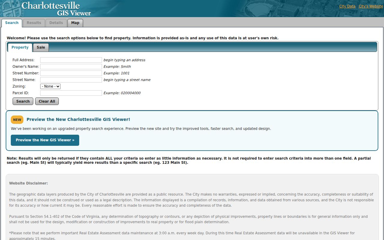
The GIS treats all entered criteria as an AND search. Start with one partial field, then identify the parcel and turn on the ZIP Code Areas layer. Adding a street, owner, and sale value together can remove a valid result.
The Virginia ZIP Code polygon layer exposes ZIP_CODE and PO_NAME fields for statewide map context.
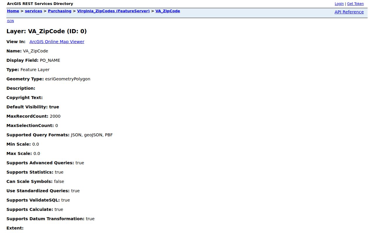
That polygon layer is useful for comparison and mapping, but USPS remains the final delivery authority for an individual address.
Search a Charlottesville ZIP Code
Finding a person or a record within a postal area starts with an address, not a ZIP-only roster. The City GIS does not document a ZIP input filter, and the Virginia voter portal requires locality or a full address for its own-status and polling-place functions. Use the ZIP layer to set context, then make the parcel or street search precise. The process protects against treating a postal range as if it were a list of households.
- Use the USPS address tool as the final check for the exact delivery ZIP. The research did not supply a city-specific USPS boundary list that can replace an address lookup.
- Enter the address or a partial street in the City GIS, then use Identify to open the mapped parcel. Confirm whether it lies inside city limits.
- Turn on ZIP Code Areas and, when useful, the precinct, polling-place, or planning-neighborhood layers. These show geographic context, not resident membership.
- For a city parcel, follow the owner, deed, court, or other record through the appropriate city custodian. For a county parcel, switch to the Albemarle office and viewer.
- Once an exact street is known, use the Charlottesville street directory for the address-keyed property workflow.
The Virginia Citizen Portal does not supply a ZIP-only resident list. A person checking their own status uses name, date of birth, last four Social Security digits, locality, and an attestation. A local registrar can explain access to any statutory public list without turning the portal into a postal-directory search.
Charlottesville ZIP Code City Limits
ZIP Code Areas and city limits describe different systems. A USPS ZIP can extend outside Charlottesville's legal boundary, and a city parcel can have a university, station, or post-office-box ZIP. The 22903 and 22906 areas are practical reminders to check locality and parcel geometry. A University of Virginia land exception in the city charter can add another jurisdictional wrinkle. Use postal data to validate delivery, then use the city or county map and the correct office for the record trail.
- ZIP versus ZIP+4
- A ZIP is the main postal routing code. ZIP+4 adds a more specific delivery segment, such as a block, building group, or receiving point.
- Post-office-box ZIP
- A ZIP used for box service or a station can describe how mail is received, not the physical location of a parcel.
- Unique ZIP
- A ZIP assigned to a single organization or high-volume receiving point rather than an ordinary delivery area.
- Carrier route
- A postal delivery grouping used within a ZIP. It is not a city boundary or a public household list.
- Situs address
- The physical location of a parcel. It can differ from the tax mailing address and from the legal description on a deed.
Charlottesville Situs Mailing and ZIP
Three labels often appear on the same record trail. The situs address is the physical parcel location. A mailing address is where a tax notice or other correspondence goes. A legal description defines the tract for title purposes. GIS and permits center on situs; tax material may display situs and mailing; deeds center on legal description and grantor or grantee. A voter record has its own statutory protections, and a historical reverse directory records the street and number as printed at the time.
Keep each label exactly as the custodian presents it. A mailing ZIP can point beyond the property, and an old address can use a historical street name. The city grid begins from Main Street and First Street, with numbering rising by 100 per block. The August 2024 City Street Index map helps normalize a modern street spelling before a property search.
Note: Do not substitute a tax mailing ZIP for a parcel situs when deciding whether a Charlottesville or Albemarle office holds the record.
Charlottesville ZIP Context After Annexation
Postal naming did not erase the record effects of Charlottesville's final 1963 annexation. Johnson Village, Greenbrier, and Barracks Road areas entered the city in that expansion, so an older deed, map, or directory may point to Albemarle while later assessment material points to the city. This is a locality-history issue, not a ZIP boundary change. It is one reason a name or address search should include the record date and the agency that held the parcel at that time.
The same caution applies to historic street names. In the 10th and Page area, 8th Street NW also appears as White Street and 10th Street NW as Jeffries. A ZIP code narrows modern postal context but cannot reconcile an older street name. Pair it with the current street index, parcel description, and historical map or deed information when an address does not match the first search.
Confirm a Charlottesville ZIP Address
Finish a Charlottesville ZIP code directory search with the delivery address itself. USPS address lookup is the final check for its ZIP assignment. The City GIS ZIP layer and the Virginia polygon service are map tools, not final delivery authorities. If the parcel is outside city limits, use Albemarle GIS and Mapping before requesting land, court, or assessment material. That extra locality check is especially important on the city edge and for University-related addresses.
For records that use a person's address, match the record's purpose to the proper source. The GIS owner field is an ownership clue. A tax mailing address is a correspondence clue. The voter portal is for the individual's protected account view, not a ZIP directory. A deed's legal description is the title anchor. Each can support a careful search, but none should be stretched into more than it actually shows.