
Walking a Charlottesville Street Directory
Begin with a physical street address in the City of Charlottesville GIS Viewer. A parcel result can supply an owner name, nine-digit parcel ID, situs address, sale history, zoning, and deed or plat reference. That is an ownership and property trail, not a roster of every person at the address. The next record should be chosen for the question at hand: the clerk for title, the assessor for parcel history, a lawful voter-list channel for statutory registration information, or a historical address directory for an earlier household.
- Search the address or a partial street name in the City GIS Viewer, and save the parcel ID, situs address, owner field, and deed or plat reference.
- Use the assessor’s parcel-history file when an older ownership, improvement, deed, or plat detail is absent from the online display.
- Search the current owner as grantee in the Charlottesville Circuit Court Clerk’s land-record index, then record the seller, legal description, and recording reference.
- For a lawful registration-record question, keep the secure Virginia Citizen Portal separate from a public list request. The portal is for a voter’s own status, not a street-by-street search.
- For an older address, inspect the name and reverse-address portions of a historical city directory, then compare the result with the deed trail.
Charlottesville is an independent city. A mailing address that says Charlottesville can still belong to an Albemarle County parcel, where county GIS and the Albemarle Circuit Court Clerk apply. Check the parcel geometry and locality before treating a street result as a city record.
Charlottesville Street Directory GIS Search
The City of Charlottesville GIS Viewer is the practical first stop for a street directory search. Its criteria are combined, so a narrow owner, street, and sale query can hide a valid parcel. Begin with one broad field. A partial street name can return a useful run of parcels, while the Identify tool, labels, and map layers add street context after a result opens.
| GIS field or tool | Format | Required | Charlottesville use |
|---|---|---|---|
| Full Address | Autocomplete or text | No | Begin typing an address; partial entry is accepted. |
| Owner’s Name | Text | No | Partial owner searching is accepted. |
| Street Number / Street Name | Text / autocomplete | No | A partial street name can return multiple parcels. |
| Parcel ID | Text | No | Use the nine-digit city identifier, such as 020004000. |
| Sale Date / Street Price | Operator plus paired fields | No | Use only when a broad address search produces too many results. |
| Identify, Measure, Zoom, Print, Share | Map tools | No | Open a parcel, examine a segment, and preserve a reproducible map view. |
The Charlottesville GIS property search shows the address and parcel search interface used for the street directory work.
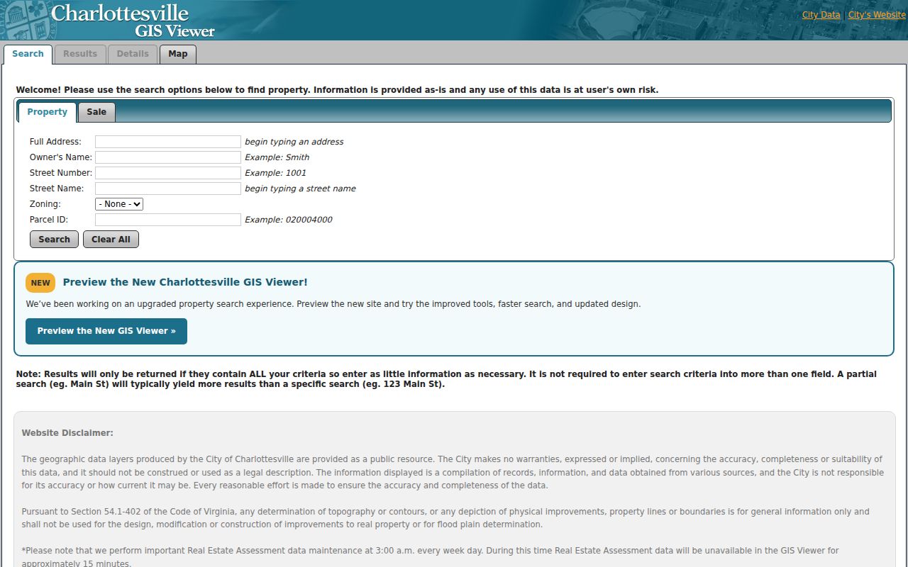
Turn on Parcels, Addresses, Parcel ID Numbers, Roads, City Limits, ZIP Code Areas, Planning Neighborhoods, Polling Places, or Voting Precincts only after locating the parcel. The viewer describes its data as general information, not a legal description, and its assessment data has a short weekday maintenance period around 3 a.m.
Charlottesville Street Records by Address
Street and parcel labels are easy to confuse. The GIS record may show both where the structure stands and where a tax notice goes. A deed may use neither street label as its main index key. Copy each label as displayed, then use the parcel ID, subdivision, lot, or other legal-description detail to keep the address chain together when a building number or street name changes.
- Parcel
- A defined unit of land in the assessor and GIS system, usually identified by a city parcel ID.
- Situs address
- The physical location of the parcel or building. It is different from a tax-roll mailing address.
- Plat
- A recorded map that can show lots, blocks, subdivision layout, and references needed to follow a deed.
- Criss-cross directory
- The address-ordered portion of a historical directory, used to move from a printed street number to a listed name.
City land books add a dated tax-roll snapshot. The Charlottesville land-books page provides unofficial taxable and exempt PDFs for 2015 through 2026, while official books stay with the Circuit Court Clerk. They show an owner, legal description, parcel number, assessed value, and levy. They do not list every occupant.
Charlottesville Street Directory Records Coverage
Address-keyed sources have different keepers and limits. The rows below separate an ownership or place record from a record that may provide a dated, lawful connection to a person. A full street directory result needs that distinction.
| Address record | Custodian | Street-level clue | Access route |
|---|---|---|---|
| GIS and assessment | City Assessor / City GIS | Parcel, owner, situs, sale, zoning, city-limit, ZIP, precinct, neighborhood | Free viewer, assessor public computer, or appointment |
| Annual land books | City / Circuit Court Clerk | Owner, legal description, parcel, assessed value, levy, taxable or exempt status | Unofficial 2015–2026 PDFs; official books at clerk |
| Deed index and images | Charlottesville Circuit Court Clerk | Grantor, grantee, instrument, date, legal description, and plat reference | SRA rules, US Land Records pay-per-view, clerk counter, or local books |
| Building permits | Neighborhood Development Services / Building Inspections | Address, work, status, inspections, and public applicant or owner fields | Guest permit tracking; targeted request for older or missing files |
| Registration records | Charlottesville Elections / Virginia Elections | Statutory public-list fields, subject to exclusions | Title 24.2 public-inspection process; Citizen Portal for self-check |
| Historical directories | JMRL, UVA, ACHS, LVA, NARA | Printed address-to-name and name-to-address clues, with gaps | PDF, catalog, microfilm, or research-library access |
When a modern address yields nothing, try the parcel’s legal description and check whether the street is city or county land. The historical collections are treated in depth on the Charlottesville city directory page.
Charlottesville Deeds Along a Street
The clerk’s land-record index is party- and recording-based, not a simple street list. Search the current owner as the grantee, inspect the instrument number or book and page, recording date, seller, consideration, legal description, and references to prior deeds or plats. Then search that seller as an earlier grantee for the same tract. A legal description can survive a parcel split or street-number change better than the street address itself.
Virginia’s Secure Remote Access land-record service explains that individual clerks decide whether free index access is enabled and who may view images. Charlottesville points land-record users to SRA/COVERS and US Land Records pay-per-view, but the local public material does not state a city online cutoff. Ask the clerk whether a specific book or image is in COVERS, US Land Records, a local terminal, or the physical record room.
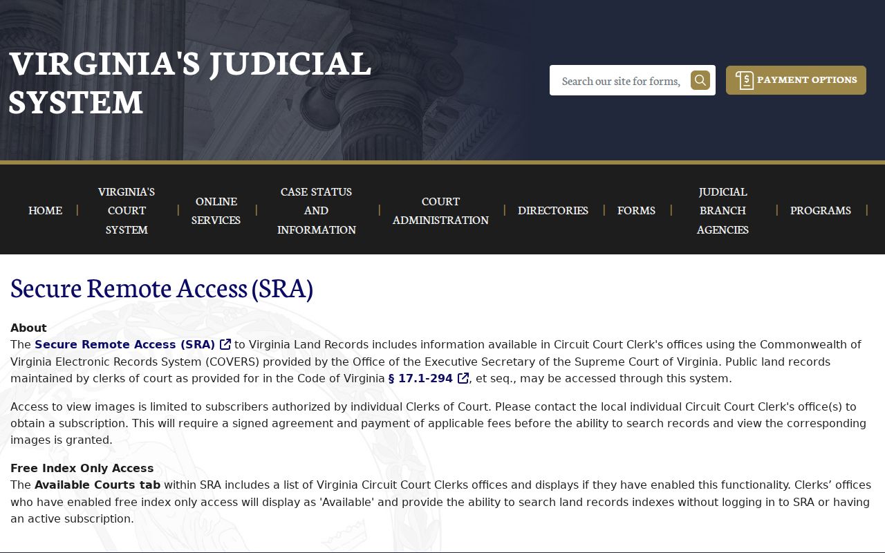
The SRA notice is a reminder that an index hit and an image are different access levels. Sensitive details from a deed image should not be republished, and the official clerk record controls if the remote display conflicts with it.
Charlottesville Street Directory Land-Book Run
The 2015–2026 unofficial land-book run is a useful numerical layer for a parcel along a Charlottesville street. Compare the same parcel across selected years to see its recorded owner, legal description, assessment, and levy at each tax-roll date. It is a focused way to spot a change that deserves a deed search. The official annual books remain with the Circuit Court Clerk, which is the fallback for a year not offered in the online PDF set.
Do not turn a land-book line into a claim about present occupancy. It identifies the owner of record for that tax year and whether the parcel appears on taxable or exempt lists. The City Assessor keeps hard-copy parcel history files for city parcels and asks callers to provide an owner name, physical address, or nine-digit parcel ID when seeking an older record.
Note: A city parcel record and a Charlottesville postal address can point to different jurisdictions, so confirm the parcel locality before comparing city and county land books.
Charlottesville Permit Addresses and Street Work
The city’s public search hub groups Building Permit Status, Cemetery Plot, and Real Estate Assessments. The permit and cemetery options are supporting address or history leads, not a current street directory. Cemetery results concern a deceased person or plot, and the public material does not state their search fields or coverage. Permit entries can date a project and may show public application, owner, contractor, work, status, or inspection details.
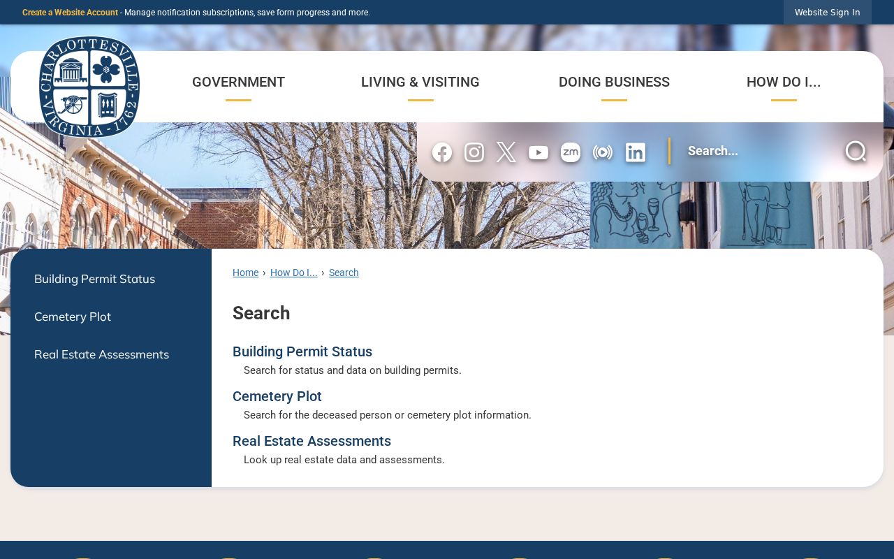
Use a permit as a dated property event. An applicant or contractor name does not establish that the person lived at the address.
The Charlottesville Public Permit Portal allows guest tracking of permits and inspections. It is the direct online channel for current tracking; older or unavailable files should be requested from Neighborhood Development Services or through the City’s Virginia Freedom of Information Act process.
Building Inspections lists phone 434-970-3008 and identifies its City Hall counter as having moved to the first floor on January 26, 2026. The public text did not expose a historic-search cutoff, so request a specific address and date range rather than assuming the portal holds every file.
Charlottesville Voter Records by Street
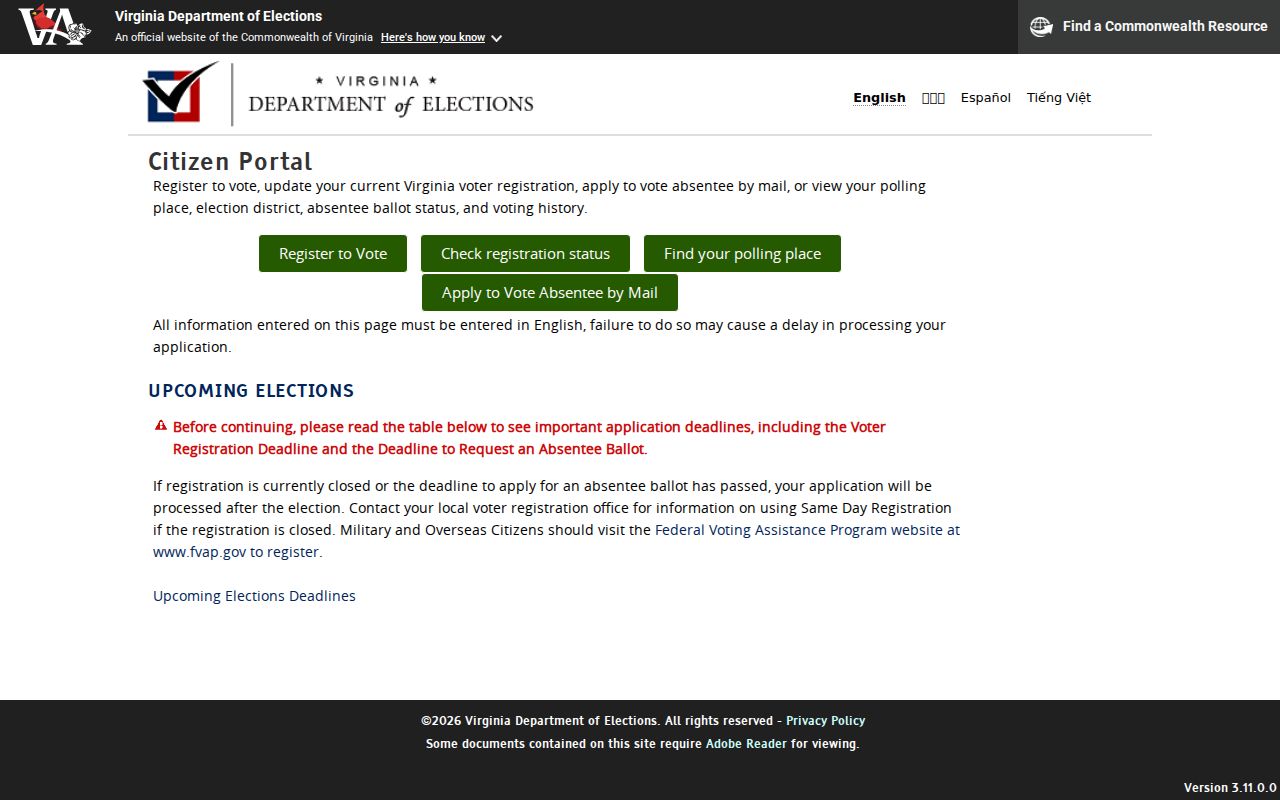
The Virginia Department of Elections Citizen Portal is a secure individual tool. It requires first and last name, date of birth, last four digits of Social Security number, locality, and certification to view a person’s own registration, polling place, election district, absentee status, and voting history. Select Charlottesville City rather than Albemarle County when the registration is in the city.
A public registration list operates under different rules. Virginia Code § 24.2-444 identifies name, address, year of birth, gender, and election districts as list content, while protected addresses, Social Security data, day and month of birth, and voting-history information are excluded or controlled. A missing name or address is not proof of no connection to Charlottesville.
Charlottesville Street Directory Name Changes
Charlottesville’s current building-number grid uses Main Street as its east-west baseline and First Street as its north-south baseline. Numbers begin at 100 at the baseline and rise by 100 per block; odd and even sides depend on the street’s orientation. The August 2024 Street Index map supplies modern spelling and grid location.
Older records can use other names. Local preservation research identifies 10th Street NW as Jeffries and 8th Street NW as White Street in the 10th and Page area. Search both names in directories, Sanborn maps, and deeds. The 1963 annexation also means a property in Johnson Village, Greenbrier, or Barracks Road may have county-era records before later city assessment records.
Charlottesville Street Directory Limits
A street directory can connect an address to a parcel, an owner of record, a dated land-book entry, a deed chain, or an older printed listing. It cannot reliably identify every current person at an address. Condo parcels, public land, vacant lots, trusts, and business ownership can make a block appear more personal than the records support. A mailing address is a correspondence clue, not proof that its recipient is at the situs address.
Lawful personal use. Charlottesville street and address records are for careful personal research, family history, property questions, and civic understanding. Never use an address trail to stalk, harass, intimidate, or harm another person.
If the goal changes from a street to confirming one specific person, use official records only for the purpose and access level they allow. The Charlottesville resident lookup route keeps that person-centered verification separate from the street-by-street chain.